Join us on a trip up or around the Sierra Nevada’s highest mountain: Mulhacen
At Mountain Walking Holidays, we often find ourselves walking the trails that lead to the 3,482 m peak of Mulhacen, the tallest mountain in the Sierra Nevada, and in fact, all of continental Spain.
A tough, but awe-inspiring climb, the trails of the legendary Mulhacen lead you through staggering landscapes and striking terrain, all with the ultimate goal of reaching the top and gazing across the breathtaking Sierra Nevada.
Getting to the Mighty Mulhacen

It’s best to set out early in the morning, with the best season for climbing being the summer months; it gets very cold in the winter! Getting there early not only allows you to get the climbing done before the heat of the day starts to sap your energy, but also before large groups of climbers can arrive to join you on your ascent.
Most people tackling Mulhacen will take the National Park bus from Capileira village up to Alto del Chorrillo, a dramatic set of rolling hillsides that lie in the shadow of Mulhacen’s peak. Here, at 2,700 m up, you’ll get a breathtaking view of mountains south ridge and the sometimes snow-capped summit that you’ll be aiming for.
If you want a more challenging experience, you can also start the climb from Hoya del Portillo, a patch of mountainous forest 600 m below Alto del Chorrillo. This is often where Mountain Walking Holidays trips up the Sierra Nevada’s tallest peak begin. Of course, it’s fine to use the bus and the south ridge, climb the peak and head back down to the bus stop, but this is a short day and will leave you wanting more; instead, we do things a little differently.
Ascending Mulhacen in the Sierra Nevada
Our trip often starts from Hoya del Portillo at roughly 2,160 m. Heading out early, climbers can enjoy the cool morning temperatures in Mulhacen’s forests. Even with the sun already high the sky, the shade of the trees makes for the perfect climate to start stretching your legs. Our motto is start cold, and warm up by walking uphill!
After our first thirty minute stint, we’ll arrive at the Puerto Molino viewpoint, with excellent views of the mountain peak. We’ll then continue along the ridge of Prado Llano before joining the old road along to Alto del Chorrillo – where most novice climbers start. If you are climbing with Mountain Walking Holidays, now is the time where we’ll stop for a snack and take in the scenery of the beautiful Sierra Nevada. We’ll then start our ascent to the summit.
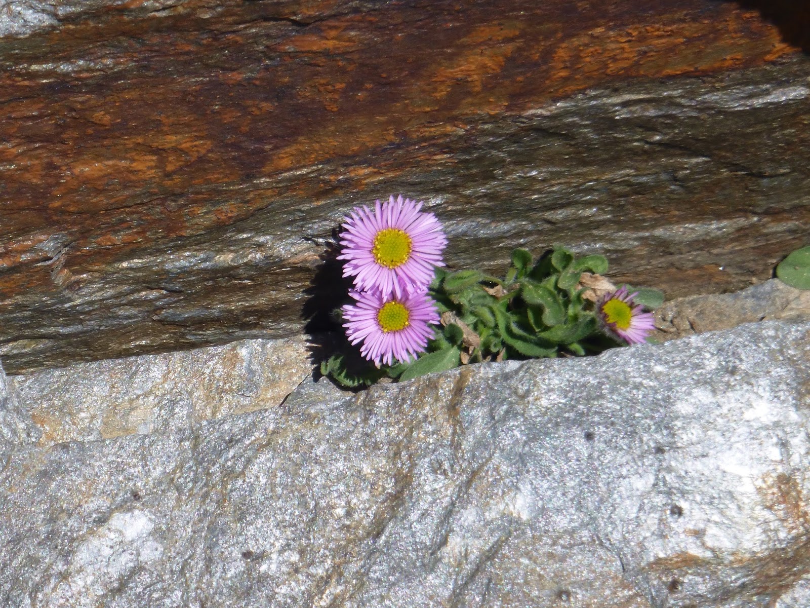
The actual climb to the peak of Mulhacen, along the south ridge, is very relaxed and enjoyable; no tough walls to scale or rocks to traverse. In the winter, this part of the trail is often coated with snow, but the summer sees the return of a well-defined path leading to the summit. This area is a great spot for taking photos of the plant and wildlife that surrounds Mulhacen’s peak.
Reaching The Summit
Around five hours after departing from Hoya del Portillo, we’ll reach the summit of Mulhacen; a distance of 11.4 km with a total height gained of 1,412 m.
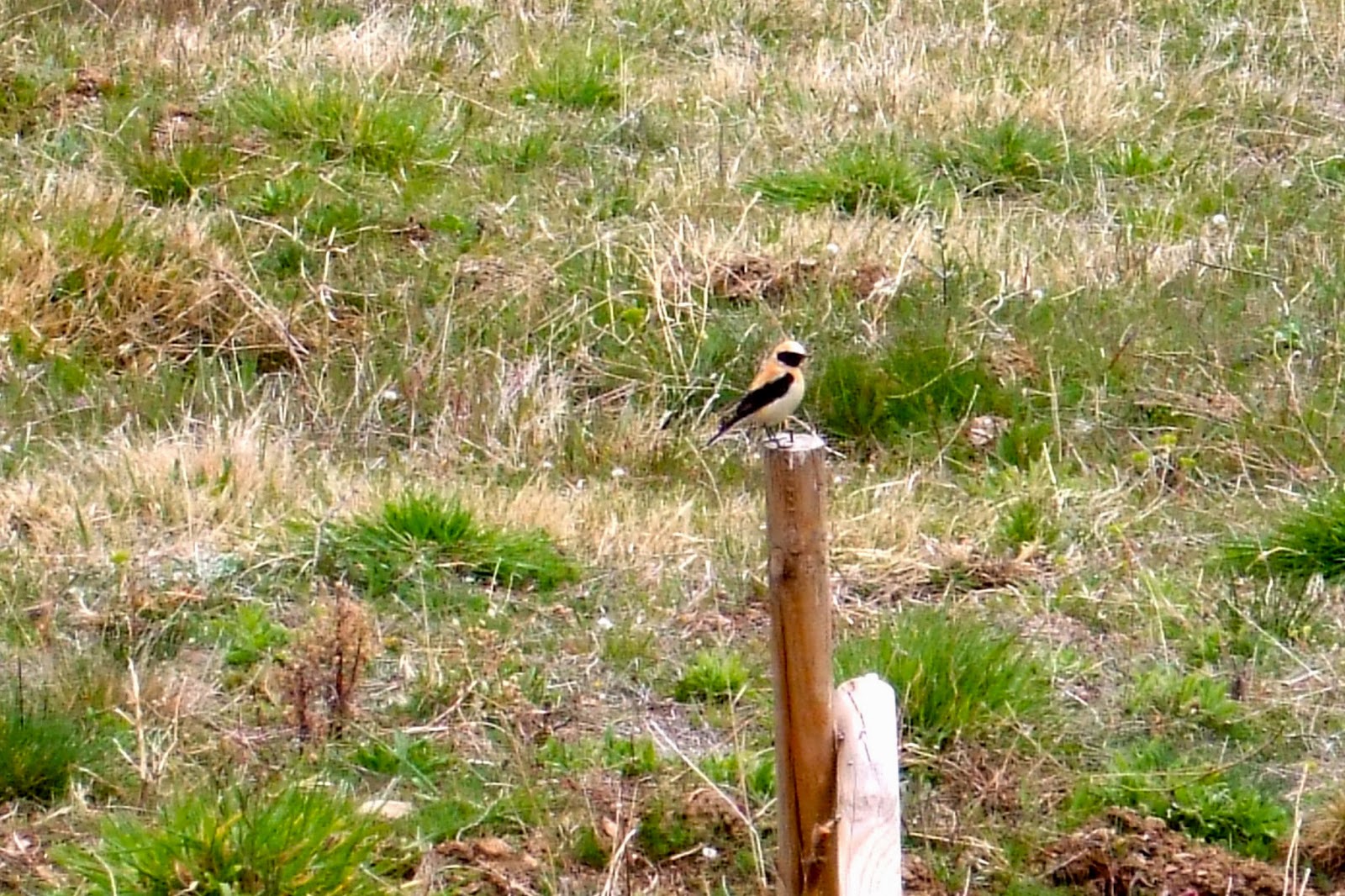
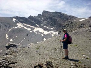
Leaving early often means we are ahead of the crowds, and the summit is usually serene and quiet. The views from the summit are simply staggering, stretching for miles over the Sierra Nevada. We also often catch glimpses of Iberian ibex while taking in the sights from the peak. Known locally as cabra, ibex are mountain goats with large, illustrious curved horns; the largest animals in the Sierra Nevada.
What Goes Up Must Come Down: Descending Mulhacen
After a short break on the summit, it’s time to descend the mountain before the crowds from Alto del Chorrillo begin to show up. Instead of taking the traditional path back down to the bus stop, we follow zigzagging path down the screes of Mulhacen’s western flank, which gives great views of both Mulhacen’s north face and nearby Alcazaba.
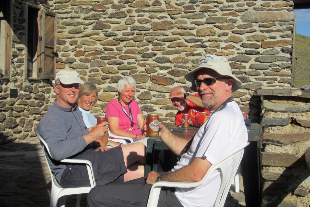
Soon climbers with Mountain Walking Holidays will reach the Caldera, a stunning basin filled with water; a beautiful contrast against the dry and rocky landscape of Mulhacen’s western slopes. Here sits an unmanned “bivouac” hut, with bunk beds, tables and chairs. From the hut, you can sit, rest and take in the impressive view back up to Mulhacen’s summit, or the landscape that surrounds you; all while enjoying a lunch supplied by our guides!
From the Caldera, circle back round to Hoya del Portillo, stopping at the mountainside Poqueira Refuge for a rest on and a bit more sightseeing on the way.
All that remains now is to drive back to a bar in Capileira for the customary drink and plan for the next outing!

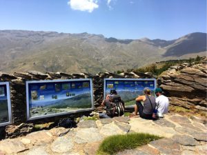 A route following the GR240 between the two highest villages in Andalucia. 6 to 7 hours walking with about 800m of ascent. However we take the National Park bus to the viewpoint of Puerto Molino 2400m where you will get your first glimpse of Mulhacen. From here the route is mostly downhill back to the GR240 and Trevelez.
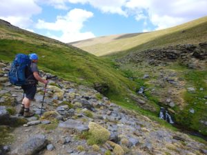 Trevelez to The Postero Alto Refuge
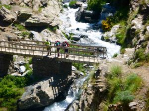
 An easier day with a chance to pass the spectacular waterfalls of Los Lavaderos de la Reina. About 6 hours walking with about 650m of ascent.
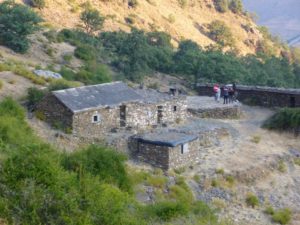 Now a final ascent begins to the Cortijos del Hornillo. Here there are several buildings and rooms that have sleeping platforms. Besides the larger of the buildings is an old threshing circle and just beyond that is a water supply. If this is not running you will have passed a small stream about 5 minutes before reaching Hornillo. Hornillo is a stunning situation to stay.
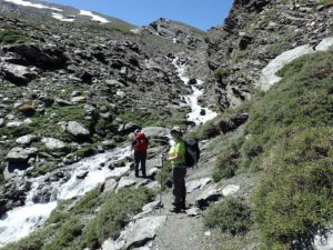
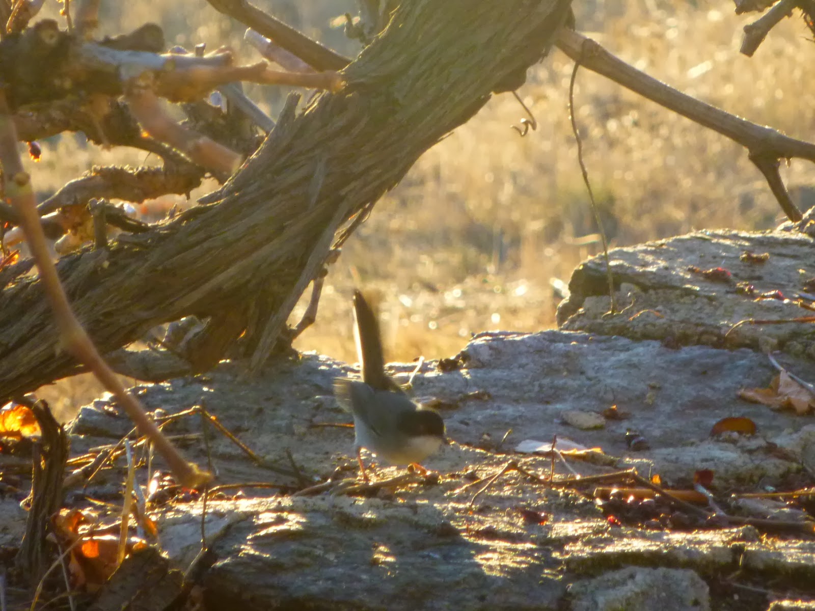
 Not as hard as you might think! Veleta means “weather vane” and at 3394m is the 2nd highest mountain in the Sierra Nevada. Our prefered option is to take the National Park bus to 3000m before the ascent of Veleta. This gives us time to take little used paths up Veleta’s north West ridge. Veleta is an easy and popular mountain and the summit is usually busy, however the path we use means we rarely pass others until we reach the summit. Today we can expect to see Ibex, Alpine Accentors and Vultures.
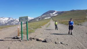 We choose to ascend Mulhacén by the “gentle” south ridge. Although this is a popular route and there will undoubtedly be others doing the same, it is a nice route offering plenty of sight seeing opportunities and some nice flowers in early summer. Our descent is via the west flank to the Caldera Refuge (bothy) with some fine views across the north face.
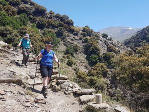 Initially a steep path down to the Cortijo las Tomas and a further descent into the delightful Rio Poqueira. The path undulates for a while and there are a couple of river crossings before our descent to the hydro electric plant and the deserted village of La Cebadilla. From here we follow the road and signposted paths back to Capileira.


 Iberian Ibex, a common sight in the Sierra Nevada
 Day 6 – Refugio Poqueira to Capileira